
3D Underground Imaging & Mapping, Australia-Wide from Scan Man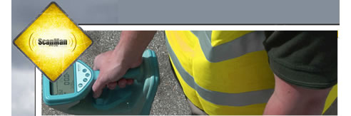 When modern concrete scanning techniques were not available, the costs associated with re-design and repair work used to be huge. Since it was impossible to look through the ground to identify leaks, voids, and internal features, changing the structures to overcome these problems was inevitable. Nowadays Ground Penetrating Radar and 3D subsurface imaging and mapping has made it quite an easy job to locate imbedded objects within the ground prior to any drilling or cutting work. Many construction sites require accurate subsurface imaging before construction begins. The modern imaging equipment consists of multi-channel 3D Ground Penetrating Radar (GPR) system, electromagnetic induction (EMI) system, and integrated GPS (Global Positioning System) antennas. Advanced technology allows collection of data rapidly and accurately. The technology also provides computer software for interpreting 3D radar and EMI data. By using this technology of 3D imaging and mapping, the technician can see deep down the surface for any impurities, ferrous objects, and power pipes. It is used to scan both metallic and non-metallic subsurface types. Today construction and law-enforcement agencies employ this technology for a detailed environmental site assessment and architectural or forensic investigations. In addition to this, 3D imaging can also be used effectively for identification of geological voids and for subsurface infrastructure mapping. A three-dimensional scan of the ground for identifying buried utilities, rock formations, and storage tanks is very easy to interpret. If the construction site does not contain many underground features then conventional methods such as traditional concrete scanning and GPR are also sufficient. However, in crowded areas and sites where many underground features are expected, 3D imaging and mapping provides more efficient results. The technology is faster and more accurate than other methods and therefore a bit more expensive. It covers a larger area in a short span of time as compared to 2D or two-dimensional imaging. Usually the data collected through 3D imaging equipment is analyzed by geophysical analysts to identify utilities in the imaged area. The result provided by this method is geo-referenced and can be viewed in a computer-aided design (CAD) application. Renowned construction companies hire expert geophysical analysts for the analysis of this type of data. Mostly they provide their own proprietary equipment and computer software for an efficient and cost-effective assessment. This specialized equipment can also be used to locate archeological artifacts, buried structures, and conduits. In addition to this, some companies employ this technology to locate vacancies in local cemeteries. Before starting any construction work, it is required to assess the ground to locate any voids and other underground features. 3D imaging and mapping is a relatively new technology for the inspection of all types of construction sites to avoid any unexpected expenses afterwards.
|
0420 307 226 249 Towen Mountain Road, Towen Mountain, QLD, 4560
|

Related News Articles
 Nationwide Ground Penetrating Radar
 Structural Scanning & X-ray Services by
 Concrete Scanning Brisbane - X-Ray
 Surface Penetrating Radar Equipment
 Surface Penetrating Radar Equipment
 Detecting Leaking Pipes Brisbane |
 Detecting Leaking Pipes Brisbane |
 Underground Scanning Services Brisbane |
 Underground Scanning Services Brisbane |
 Surface Penetrating Radar Brisbane |
 Surface Penetrating Radar Brisbane |
 3D Underground Scanning Services
 3D Underground Scanning Services
 Bore Hole Safety Check | Scan Man
 Bore Hole Safety Check | Scan Man
 Underground Cable Location | ScanMan
 Underground Cable Location | ScanMan
 Concrete Scan/Xray Queensland from
 Concrete Scan/Xray Queensland from
 Geophysical Surveys with Concrete
 Geophysical Surveys with Concrete
 Underground Cable Locating Equipment
 Underground Cable Locating Equipment
 Ground Penetrating Radar Brisbane from
 Ground Penetrating Radar Brisbane from
 Concrete X-Ray Brisbane from ScanMan
 Concrete X-Ray Brisbane from ScanMan
 3D Imaging Services Sunshine Coast from
 3D Imaging Services Sunshine Coast from
 Utility Locators Sunshine Coast from
 Utility Locators Sunshine Coast from
 Underground Locators Gold Coast from
 Underground Locators Gold Coast from
 GPR Services Gold Coast from ScanMan
 GPR Services Gold Coast from ScanMan
 Concrete Testing Services Gold Coast
 Concrete Testing Services Gold Coast
 |
 |
Home | About/Services | News Lounge | News Archive | Product Archive | Tender News | Testimonials | Conditions of Use | Privacy Policy | Stats
![]()
![]()
![]()
![]()
© SPEC-NET